









India’s economy still turns, to a significant degree, on the southwest monsoon. Roughly half the country’s cropped area is rain-fed, reservoirs refill during four months of rain, and the price of staples tracks the season’s progress from June to September. So when a super El Niño forms in the Pacific, the question in India is always the same: what will it do to the monsoon?
The honest answer is that it raises the risk without determining the outcome. El Niño years are over-represented among India’s droughts — but most El Niño years have not produced a drought, and one of the strongest events on record passed with an almost normal monsoon. Knowing which years went which way, and why, is more useful than the headline association.
Why El Niño weakens the monsoon
The southwest monsoon is driven by a temperature and pressure contrast: the Indian subcontinent and the surrounding landmass heat up through spring, drawing moist air in from the cooler Indian Ocean. El Niño disrupts this at several points simultaneously.
- The Walker circulation shifts. Rising motion — and with it the deep convection that drives large-scale circulation — moves eastward into the central Pacific. The descending branch settles over the eastern Indian Ocean and maritime continent, which suppresses convection over the Indian Ocean and the subcontinent.
- Upper-level winds change. The tropical easterly jet, which helps organise monsoon depressions, weakens or shifts.
- Monsoon depressions form less often. These low-pressure systems over the Bay of Bengal historically supply a large share of central and northern India’s seasonal rainfall. Fewer of them means a lower seasonal total even if the monsoon onset looks normal.
- Longer dry breaks. El Niño is associated not just with less rainfall overall but with more persistent breaks within the season — stretches of several days to weeks where the rain stops entirely.
The effect is strongest when the event is developing during the monsoon season, and weakest when it develops late or is already decaying.
It is a probability, not a forecast
This is the single most important point, and it is routinely flattened in news coverage.
Statistics for India show that most drought years coincide with El Niño — the severe monsoon failures of 1877, 1899, 1918, 1972, 1982, 1987, 2002 and 2009 all occurred during El Niño episodes. But the reverse does not hold: the majority of El Niño years gave India normal or near-normal rainfall.
Two cases make the point better than any table:
| Year | El Niño strength | Indian monsoon (departure from normal) |
|---|---|---|
| 1997–98 | Very strong (peak ≈ 2.4 °C) | Near normal — no drought |
| 2009–10 | Strong (peak ≈ 1.6 °C) | Deficient — a drought year |
| 2015–16 | Very strong (peak ≈ 2.6 °C) | Deficient, though not a full drought |
| 2023–24 | Very strong (peak ≈ 2.0 °C) | Below normal, but no drought |
1997–98 is the famous counterexample: the strongest event of the late twentieth century, and the monsoon that year was close to normal. The main reason was the Indian Ocean Dipole — a positive IOD phase, with warmer water off Sumatra and cooler water off Africa, which partially offsets the El Niño signal over the Indian Ocean. 2023 shows the same principle in the other direction: a very strong event without a drought.
What actually goes wrong
When the effect does bite, the failure is rarely a uniform shortage of rain across four months. It has a recognisable shape.
A hotter spring
El Niño tends to raise temperatures over the subcontinent before the rains arrive. The months of March to May see more frequent and more intense heatwaves — a direct effect on health and on power demand, arriving before the monsoon can moderate conditions.
A delayed or disorganised onset
The monsoon’s normal northward advance from Kerala can stall. A late onset compresses the growing season and delays sowing, with knock-on effects that persist even if later rainfall recovers.
Longer breaks during the season
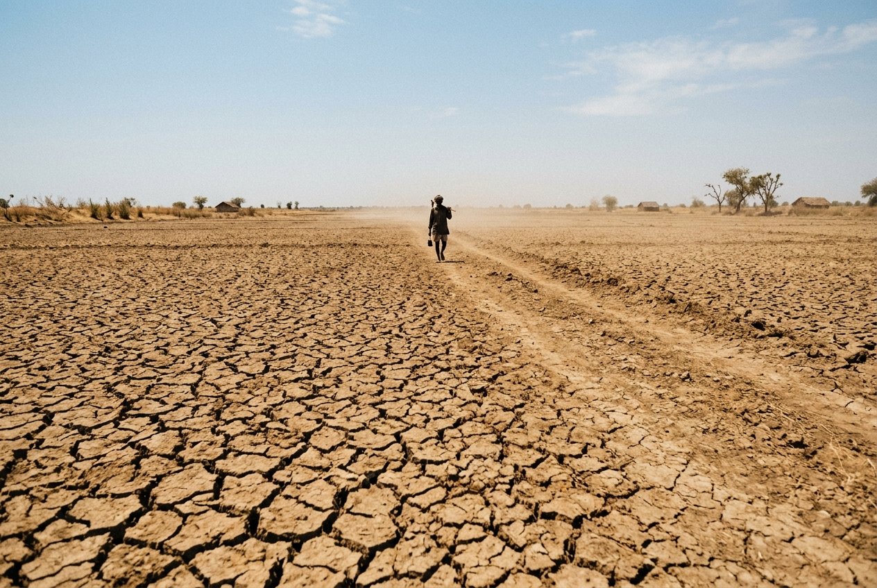
Perhaps the most damaging feature. A monsoon can post a near-normal seasonal total while still ruining crops — because the rain arrived in heavy bursts separated by long dry breaks at the wrong points in the crop cycle. Rainfall timing matters as much as rainfall volume, and this is where the seasonal average hides the real story.
Uneven distribution
The deficit is rarely shared evenly. Some regions may receive normal rain while others fail badly, so national averages can look acceptable while particular districts are in crisis.
Agriculture by crop
Kharif crops — sown with the monsoon and harvested in autumn — are directly exposed. Which crops suffer depends on where the deficit falls, but the general pattern is:
- Paddy is water-intensive and dominates the rain-fed area. A weak monsoon cuts transplanted paddy first, and reservoir levels determine whether irrigation can compensate later.
- Pulses are largely grown on residual moisture in central India and are disproportionately affected — which matters because India imports much of its pulse requirement, so a domestic shortfall translates quickly into prices.
- Cotton and oilseeds in the rain-fed western and central belts are sensitive to dry spells during flowering.
- Sugarcane is perennial and heavily irrigated, so it is more resilient to rainfall shortfall but contributes to reservoir drawdown.
- Groundnut and soybean respond sharply to dry spells at specific growth stages rather than to seasonal totals.
The indirect effect is often larger than the direct one. A weak monsoon raises input costs, reduces sowing area, lifts food prices and squeezes rural incomes — which then feeds into consumption across the economy. Food inflation in India has historically tracked monsoon performance closely.
Water supply and reservoirs
Reservoir levels entering and passing through the monsoon determine how much of the shortfall can be absorbed. A deficient season that follows a healthy one is manageable. A deficient season that follows another weak year compounds quickly, because reservoirs have no time to recover.
Groundwater is the other buffer, and the one that depletes rather than replenishes during a bad year. Pumping increases exactly when recharge falls — which is how a single poor monsoon can raise the water table deficit for years rather than months. Municipal supply, drinking water and power generation (a large share of Indian hydro capacity depends on monsoon-fed storage) all follow from the same reservoir position.
Fisheries
El Niño reduces upwelling across the eastern Pacific, which collapses productivity there — anchoveta landings fall, seabirds starve. The effect on India’s own coasts is more indirect and less uniform, but it is real: changes in sea-surface temperature and mixed-layer depth alter plankton productivity, which moves fish and changes catch efficiency. Fishermen working the southwest coast report shifts in the timing and location of catch during strong El Niño years, with knock-on effects for processing and export-dependent coastal economies.
Health effects
The health consequences follow from the weather rather than from the ocean directly. The main pathways are:
- Heat stress during an intensified pre-monsoon season, with occupational exposure for outdoor workers and elevated risk for the elderly.
- Water scarcity — reduced availability and poorer quality as sources shrink, which raises the risk of waterborne disease. This is covered in detail in El Niño and human health.
- Nutrition, following crop shortfall and food price increases, with the effect concentrated in children and low-income households.
- Vector-borne disease, whose relationship with rainfall is nonlinear — both flooding and drought can increase transmission through different mechanisms.
For context on the mosquito-borne disease most relevant to India, see the dengue guide.
What is done about it
India has invested heavily in managing this risk, because the exposure is well understood:
- Seasonal forecasting. The India Meteorological Department issues long-range forecasts from April and updates them through the season, using dynamical models alongside statistical relationships.
- The Indian Ocean Dipole. As noted above, IOD phase can offset or amplify an El Niño signal. Forecasting both gives a materially better monsoon outlook than either alone — this is the single biggest reason 1997 was survivable.
- Reservoir management. Scheduling releases against expected inflow, balancing irrigation, drinking water and power.
- Crop and sowing advisories. District-level guidance on sowing dates and crop choice based on forecast rainfall.
- Buffer stocks and procurement. Food grain stocks act as a shock absorber against both availability and price.
The Indian Ocean Dipole is now part of routine seasonal reasoning, and its inclusion is a major reason forecasts have improved even though the El Niño–monsoon relationship itself has weakened over recent decades.
Frequently asked questions
Does a super El Niño mean drought in India?
No. It raises the odds substantially, but most El Niño years do not produce an Indian drought, and the very strong 1997–98 event gave India near-normal rainfall. Treat it as elevated risk requiring preparation, not as a prediction.
Which years were actually hit?
The clearest drought years that coincided with El Niño include 1972, 1982, 1987, 2002 and 2009. Of the very strong events, 2015–16 produced deficient rainfall; 1997–98 and 2023–24 did not produce a drought.
Can anything cancel out an El Niño?
A positive Indian Ocean Dipole partly offsets it by supplying warmer water and enhanced convection over the eastern Indian Ocean. This is the main explanation for 1997. Negative IOD phases tend to reinforce the El Niño signal instead.
When are the effects felt?
Pre-monsoon heat in March–May is usually the first signal. The monsoon itself runs June to September, and effects on agriculture are most sensitive to dry spells at sowing, flowering and harvest. Reservoir and groundwater consequences can extend well into the following year.
How does this differ from climate change?
El Niño is natural short-term variability; climate change is a long-term trend in background conditions. They interact — a warmer baseline means the same anomaly produces higher absolute temperatures — but they are distinct phenomena with different timescales. They should not be used to explain each other.
General information only. For medical concerns, consult a qualified clinician — see the medical disclaimer.