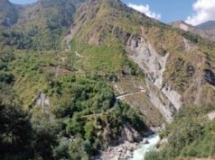










On 26 August 2026, an ice-rock avalanche in Rasuwa district sent a flash flood down the Bhotekoshi and Trishuli river system, killing more than a thousand people. It was the worst flood in Nepal in decades. It was also, importantly, not a glacial lake outburst flood — the standard explanation people reach for when they hear “Himalayan flood.”
That distinction matters, because the flood that people worry about most in Nepal is a different event entirely, and the lakes that cause it have names, locations and known sizes. This is a guide to the ones that official studies have flagged, what scientists know about each, and what has actually been done about them.
What a glacial lake outburst flood actually is
A glacier that melts faster than it receives snow leaves a depression behind. Water collects in it, and the resulting lake is held in place by something: a wall of loose rock and debris called a moraine, or the ice of the glacier itself. A glacial lake outburst flood, or GLOF, is what happens when that containment fails and the lake releases suddenly.
There are three main variants, and the name changes with the type of dam:
- Moraine-dammed GLOF — the lake is held by a pile of unsorted rock left by a retreating glacier. This is the type that threatens Himalayan valleys, and the most dangerous, because moraine material is unconsolidated and can be pierced by a small surge.
- Ice-marginal lake drainage — the lake is dammed by the glacier’s own ice front, which can fail as the ice thins and melts.
- Jökulhlaup — a sub-glacial lake beneath the ice bursts. The term comes from Icelandic and was originally tied to volcanic eruptions beneath Vatnajökull.
The scale is hard to overstate. Lake volumes range from millions to hundreds of millions of cubic metres, and peak flows of up to 15,000 cubic metres per second have been recorded in such events. For comparison, that is enough water moving in a single second to flood a football pitch to a depth of roughly 25 metres. A canyon that normally carries a small mountain stream can carry a wall of water tens of metres deep.
What makes these floods especially destructive downstream is that they keep eroding as they travel. The flood peaks grow as it carves its own riverbed through the steep moraine valleys, then spreads out slowly across the floodplain once it reaches flatter ground — inundating land up to 10 kilometres wide.
Why the Himalaya has so many of them
Two things combine here. First, warming raises the rate at which glaciers retreat, which is what creates and enlarges these lakes in the first place. Second, the Himalaya sits in geologically active terrain, where earthquakes and landslides can also trigger lake failures.
The scale of the exposure is significant. A 2023 study estimated that around 15 million people live at risk from glacial lake outburst floods, concentrated in China, India, Nepal, Pakistan and Peru.
Nepal is a particular case of study because of its density of settlement in steep river valleys. Villages sit at the bottom of the same gorges that would carry a flood wave, often with a road and a bridge as the only link to the outside.
The lakes that have been flagged as dangerous
Tsho Rolpa — the largest and the most studied
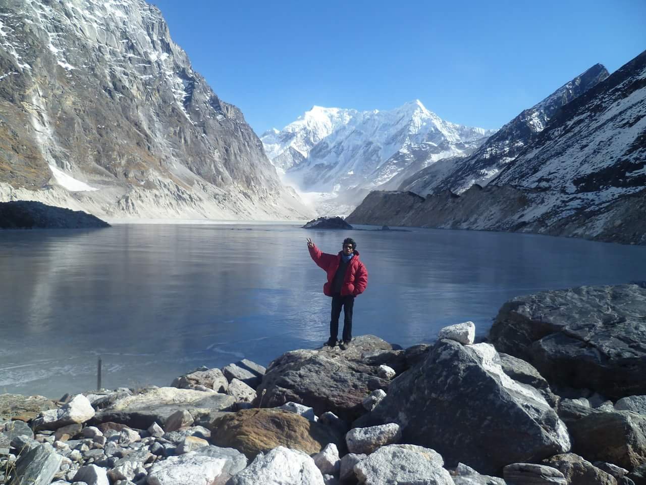
Tsho Rolpa, also spelled Cho Rolpa, is the lake most often described as the most dangerous glacial lake in Nepal. It sits at 4,580 metres in the Rolwaling Valley of Dolakha district, about 110 kilometres northeast of Kathmandu.
| Detail | Value |
|---|---|
| Location | Rolwaling Valley, Dolakha district, Bagmati province |
| Surface elevation | 4,580 m |
| Surface area | 1.537 km² |
| Maximum length | 3.45 km |
| Water volume | 85.94 million cubic metres |
| Maximum depth | 135 m |
| Dam | Unconsolidated terminal moraine roughly 150 m high |
| Fed by | Trakarding Glacier |
| Drains into | Rolwaling and Tamakoshi rivers |
| People threatened | More than 6,100 villagers along the Tamakoshi |
Those figures come from a 2014 assessment published in Natural Hazards by Shrestha and Nakagawa, which is the standard reference on the site. The 150-metre dam is unconsolidated rock, and the concern is straightforward: if water overtops or seeps through that wall, the failure can be rapid and the lake empties down the valley.
The lake has grown considerably over roughly the last 50 years as the Trakarding Glacier has retreated.
One detail from Tsho Rolpa’s history is worth dwelling on, because it is a warning about infrastructure rather than about ice. An early warning system was installed by Nepali authorities in the late 1990s. By 2010 it was reported to be lying defunct, and in 2012 the UNDP reported that it would be replaced with a modern system. A warning system that falls out of service is the same as no warning system at all, and this is not unique to Nepal.
Imja Tsho — the fastest-growing, and the one that was drained
Imja Tsho is the lake most people have heard of, because it sits on the Everest trekking route between the Imja Glacier and Lhotse Shar. Its growth has been documented in unusual detail, which makes it the clearest available example of how fast these lakes appear.
| Detail | Value |
|---|---|
| Location | Solukhumbu district, Everest region |
| Surface elevation | 5,004 m |
| Surface area | 1.3 km² |
| Maximum depth | 90.5 m |
| Water volume | 0.0358 km³ |
| Dam | Terminal moraine and the glacier snout |
| Drains into | Dudh Koshi sub-basin |
The timeline is the striking part. The lake did not exist as a recognisable feature until the 1950s, when meltwater first began collecting at the foot of the Imja Glacier. A satellite image from 1962 showed a few ponds totalling roughly 0.03 km². The ponds merged into a single supra-glacial lake in the 1970s, and the lake has grown continuously since. It reached about 0.8 km² by 2000, and 1.055 km² by November 2009, with the growth rate increasing over that period. A 2009 study in the Norwegian Journal of Geography described it as one of the fastest-growing lakes in the Himalayas.
Imja Tsho also carries the best-known example of active risk reduction. In 2016, the UNDP worked with Nepal’s army and the Department of Meteorology and Hydrology, with Global Environment Facility funding, to build an outlet and drain more than 4 million cubic metres of water from the lake. This is what engineers call siphoning or controlled drainage — lowering the lake level to reduce the pressure on the dam. It works, and it has been used elsewhere, but it buys time rather than a permanent solution, because the glacier feeding the lake keeps retreating.
Lower Barun
Lower Barun sits in the Arun basin of eastern Nepal. It was one of five lakes that Nepal’s Water and Energy Commission Secretariat formally identified as potentially dangerous in 1996. The barai means it sits in the upper Barun valley, one of the more remote glacier systems in the country, which is a large part of the monitoring challenge.
Dig Tsho
Dig Tsho also appears on that 1996 list, and it carries a specific place in the history of the subject: the 1985 Dig Cho outburst is the event that prompted detailed scientific study of glacial lake outburst floods in Nepal. Before that, GLOFs were recorded as a recurring local hazard without systematic study.
Thulagi — the one scientists ruled down
Thulagi, in the Upper Marsyangdi basin, is included in most lists, but for a different reason than the others. German and Nepali researchers — the Kreditanstalt für Wiederaufbau and the Federal Institute for Geosciences and Natural Resources, working with Nepal’s Department of Hydrology and Meteorology — studied the Thulagi Glacier and concluded in 2011 that even assuming the worst case, a disastrous outburst of the lake could be excluded in the near future.
Thulagi is worth including for that reason. Any honest list of dangerous Himalayan lakes has to be able to include a lake that was studied and cleared, otherwise the list is just alarm.
How the official list grew
The expansion of the known risk list over time is the single most useful thing to understand about this problem.
- 1985 — The Dig Cho outburst triggers detailed study of the phenomenon in Nepal.
- 1996 — Nepal’s Water and Energy Commission Secretariat identifies five potentially dangerous lakes, all above 4,100 m: Dig Tsho, Imja, Lower Barun, Tsho Rolpa and Thulagi.
- 2001 — A joint ICIMOD and UNEP study reports 20 potentially dangerous lakes in Nepal. GLOF events had already occurred in ten of them, and some were regenerating afterwards.
- 2023 — A global study estimates roughly 15 million people at risk across the five most affected countries.
A list that grows from five lakes to twenty in five years is not a list of newly discovered lakes. It is a list of lakes that were always there and are increasingly being recognised.
Recent events in Nepal
The most recent destructive GLOFs in Nepal include a flood at Thame, reported by Gorakha Patra as caused by the outburst of two glacial lakes. The title of that report is the important part: more than one lake can fail in a single event.
In 2025, Reuters reported that drainage of a Tibetan glacial lake triggered a deadly flood in Nepal. This case is worth noting because the lake was outside Nepal entirely. A transboundary event can produce a flood in a neighbouring country, which makes national monitoring incomplete by definition. Dams in the Tibetan Plateau that feed streams crossing into Nepal remain a recognised risk.
And then there is the event that opened this article. The August 2026 flood in Rasuwa was described in the EU Civil Protection daily map as an ice-rock avalanche triggering a flash flood — a mass of ice and rock descending and entraining water, rather than a lake dam failing. The flood it produced was of the same scale people associate with a GLOF. The mechanism was not.
Our coverage of that flood is here, including the death toll figures from Bagmati province’s preliminary assessment.
What determines whether a lake is dangerous
Two things decide whether a particular lake threatens people downstream, and both are routinely assessed:
- The volume of water behind the dam. A bigger lake releases more, and the flood wave scales with it. This is why Tsho Rolpa’s 86 million cubic metres makes it a primary concern.
- What lies downstream. This is frequently the deciding factor, and it is where the human cost is set. A large lake above an empty valley is a hazard. The same lake above a valley with villages, a road and a bridge is a catastrophe. Tsho Rolpa threatens more than 6,100 people; the reason is not only the lake.
Also relevant is the condition of the dam. An unconsolidated moraine is inherently unstable, and seepage through it can progressively erode it — a slow process that can be monitored. Detection and instrumentation exist, but as the Tsho Rolpa warning-system history shows, maintenance is the weak link, not technology.
Frequently asked questions
What is the most dangerous glacial lake in Nepal?
Tsho Rolpa in Dolakha district is the lake most frequently identified as Nepal’s largest and most dangerous, holding about 86 million cubic metres behind a roughly 150-metre unconsolidated moraine dam, with more than 6,100 people downstream on the Tamakoshi. That ranking comes from the 2014 Natural Hazards assessment by Shrestha and Nakagawa.
What is a GLOF?
A glacial lake outburst flood is the sudden release of water from a lake formed by glacier melt, when its dam fails. The dam is usually a moraine of loose rock left by the retreating glacier. Peak flows can reach 15,000 cubic metres per second.
How many glacial lakes in Nepal are dangerous?
Nepal’s Water and Energy Commission Secretariat flagged five potentially dangerous lakes in 1996. A joint ICIMOD and UNEP study in 2001 reported 20. The list has continued to be refined since, and studies of individual lakes have since cleared some — Thulagi was excluded in 2011.
Was the 2026 Nepal flood a GLOF?
No. The EU Civil Protection daily map of 2 September 2026 describes it as an ice-rock avalanche that triggered a flash flood, with the avalanche attribution coming from Nepal’s national disaster agency and USGS. That is a different mechanism from a lake dam failure, although the resulting flood had a similar scale.
Can dangerous glacial lakes be fixed?
Partly. Controlled drainage is the proven method. In 2016 the UNDP, Nepal’s army and the Department of Meteorology and Hydrology built an outlet at Imja Tsho and drained more than 4 million cubic metres of water, lowering pressure on the dam. Because the feeding glacier keeps retreating, this reduces risk over years rather than removing it.
Which people are most at risk?
Communities in steep river valleys below these lakes, where a flood wave has nowhere to dissipate. A 2023 study estimated around 15 million people are at risk globally, mostly in China, India, Nepal, Pakistan and Peru.
Sources
- Shrestha, Badri Bhakta; Nakagawa, Hajime (March 2014), “Assessment of potential outburst floods from the Tsho Rolpa glacial lake in Nepal,” Natural Hazards 71(1): 913–936: doi.org/10.1007/s11069-013-0940-3
- Watanabe, Teiji; Lamsal, Damodar; Ives, Jack D. (2009), “Evaluating the growth characteristics of a glacial lake and its degree of danger of outburst flooding,” Norwegian Journal of Geography 63(4): 255–267: doi.org/10.1080/00291950903368367
- Badri Shrestha; Hajime Nakagawa; Kenji Kawaike; Hao Zhang (2012), “Glacial and Sediment Hazards in the Rolwaling Valley, Nepal,” International Journal of Erosion Control Engineering 5(2): 123–133: doi.org/10.13101/ijece.5.123
- Khadka, Navin Singh (31 October 2016), “Nepal drains dangerous Everest lake,” BBC News.
- Darnal, Subash (17 August 2024), “Flood in Thame due to outburst of two glacial lakes,” Gorakha Patra.
- Sharma, Gopal (10 July 2025), “Tibetan glacial lake drainage triggered deadly flood in Nepal, climate body says,” Reuters.
- Emergency Response Coordination Centre (ERCC), DG ECHO Daily Map, “Nepal, China: EU-response to ice-rock avalanche and flash flood event,” 2 September 2026 (public domain): commons.wikimedia.org
- ICIMOD and UNEP (2001), study identifying 20 potentially dangerous glacial lakes in Nepal, cited in the literature on Nepal’s glacial lake inventory.
This article is general information about a natural hazard. It does not predict any specific event, and official warnings for Nepal come from the Department of Meteorology and Hydrology and the National Disaster Risk Reduction and Management Authority.